The city of the coast. Nearly every mile of the Peninsula's oceanfront — the lighthouse, the coves, the preserve, the resort, and the restless land of Portuguese Bend — belongs to the Hill's youngest and largest city.
Rancho Palos Verdes exists because its residents willed it into being. In the early 1970s, with Los Angeles County planning to approve dense development across the Hill's unincorporated coast, a grassroots "Save Our Coastline" movement gathered signatures, won the vote, and incorporated the city on September 7, 1973 — expressly to keep the coast open, the lots large, and the ridgelines unbuilt.
Fifty years on, that founding instinct still defines RPV: a roughly 1,500-acre nature preserve instead of subdivisions, a coastline of public trails and tide pools instead of private seawalls, and a city government whose hardest work is managing the one thing no council can legislate — the ground itself.
RPV is a city of neighborhoods rather than a city with a downtown. Its residents shop in Rolling Hills Estates or down the hill, and in exchange they get what no other city in Los Angeles County has: this coast.
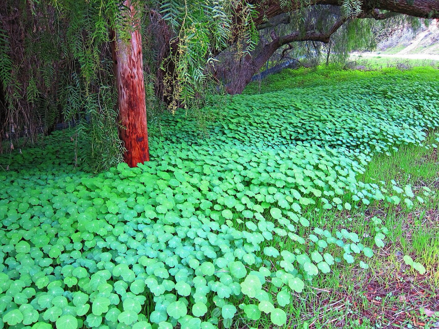
Above Abalone Cove · Jim Helvey, CC BY 3.0, via Wikimedia Commons
| Incorporated | September 7, 1973 — the Peninsula's youngest city |
| Population | 42,287 (2020 Census) |
| Land area | ≈ 13.5 square miles, with roughly 7.5 miles of coastline |
| Government | General-law city, council–manager; five council members, rotating mayor |
| City hall | 30940 Hawthorne Blvd (the old Nike missile-era Civic Center site) · rpvca.gov |
| ZIP code | 90275 (Rancho Palos Verdes) |
| Schools | Palos Verdes Peninsula USD; Eastview families may also choose LAUSD under state law |
| Police / fire | L.A. County Sheriff (Lomita Station) · L.A. County Fire |
The Greater Portuguese Bend landslide complex underlies a section of southern RPV. After the record rains of 2023–24 accelerated movement to unprecedented rates, the city's emergency dewatering wells slowed it dramatically — below one inch per week on average as of the August 2026 survey. Some neighborhoods remain under building moratoriums that date to 1978, and buyers anywhere south of Crest Road should understand the geology before they fall in love. Our explainer →
Point Vicente Lighthouse (1926) · Point Vicente Interpretive Center & whale-watch deck · Terranea Resort (on the old Marineland site) · Abalone Cove Shoreline Park · Del Cerro Park & the Preserve · Trump National Golf Club · Ladera Linda Community Center · the site of Wayfarers Chapel, closed and carefully dismantled in 2024 for eventual relocation.
Neighborhood positions are approximate centers, not legal boundaries — many RPV neighborhoods are defined by tract, HOA, or simply habit. Corrections from residents are welcome: tell us.
West to east along the coast, then up and over the Hill. RPV has no official neighborhood registry; these are the names residents, HOAs, and real-estate listings actually use.
The city's newest luxury enclave, built in the late 1990s on the last big open bluff north of the lighthouse. Wide streets, Mediterranean estates, and a public bluff-top trail that loops the whole development — a condition RPV extracted from the developer, in classic RPV fashion. Steps from the Point Vicente Interpretive Center and the December-to-April gray-whale census.
Mid-century tract neighborhoods wrapped around Los Verdes Golf Course, the county course whose back nine hangs over the ocean. Post-and-beam and ranch homes from the early 1960s, many with Catalina views over the fairways. Some of the best value-per-view math on the Peninsula.
Quiet cul-de-sac country on the Hill's northwest shoulder, sharing a border (and a school, Vista Grande Elementary) with upper Palos Verdes Estates. Harbor-and-city lights views to the north, quick access down Hawthorne to the beach cities, and a strong feeder pattern into Palos Verdes High.
RPV's most convenient address: minutes from Peninsula Center's shops, the library, and Silver Spur Elementary. A mix of 1950s–60s ranches, townhome communities, and the senior-living campuses along Crestridge. This is where the Hill runs its errands.
At the top of Crenshaw Boulevard, where the road famously ends at the Preserve gate. Island View is one of RPV's few guard-gated communities; Del Cerro's park is the Hill's favorite sunset overlook, gazing down the slide-sculpted amphitheater of Portuguese Bend to the sea. Trailhead parking debates are a perennial neighborhood sport.
A grid of single-story homes on the ocean side of Palos Verdes Drive South with front-row seats to Catalina. Seaview sits at the edge of the active slide zone — parts of the neighborhood saw utility disruptions in 2024 — and its residents have become some of the city's most engaged geology watchers.
The most beautiful and most complicated neighborhood on the Hill: dirt-road bohemian ranchettes, horse corrals, and mid-century homes scattered through the rolling land between Del Cerro and the sea. The ancient landslide beneath it reactivated in 1956 and has moved ever since — homes here ride on adjustable foundations, and the community's resilience is its own culture. The Portuguese Bend Riding Club and the annual horse show carry the old California feel.
A gated colony of beach cottages on the Hill's only true sand beach, founded in the 1920s as part of Frank Vanderlip's seaside vision. Handed down through families for generations; when a cottage trades, it trades quietly.
Mid-century neighborhoods tucked against the Forrestal Reserve's dramatic quarry cliffs. The city's striking new Ladera Linda Community Center & Park opened in 2023 and anchors the neighborhood; the Forrestal trailhead is the locals' back door into the Preserve.
Ocean-view streets climbing from Palos Verdes Drive South near the city's eastern coast, beside the famous switchback climb of PV Drive East. Below sit the public trails of Ocean Trails Reserve and Trump National — whose original 18th hole slid into the sea in 1999, a very Peninsula origin story.
High on the Hill's eastern shoulder with straight-shot views of the harbor, the bridge, and (of course) Catalina. Served by its namesake elementary school and Miraleste Intermediate; a favorite of families who want east-side sun and a faster run to the freeway.
One of the four original 1920s Palos Verdes Project villages, and it shows: Italian-revival homes on pepper-tree lanes, its own little plaza with a fountain, and the landmark Miraleste Intermediate campus. Some Miraleste-area streets even keep their own library district and a distinct old-Peninsula identity — 90275 address, 1920s soul.
Annexed from unincorporated county land in 1983, the Eastview area along Western Avenue is RPV's most walkable, most affordable quarter — and its most unusual school situation: by state law, Eastview families may choose Palos Verdes Peninsula USD or LAUSD. Rolling Hills Riviera climbs the slope above, a mid-century neighborhood that straddles the RPV/Lomita line.
Portuguese whalemen from the Azores build a shore whaling station at the cove that will forever carry their name. Captain Frank Anderson's crews render 2,166 barrels of oil from migrating gray whales between 1874 and 1877 before the station is abandoned — its site is California Historical Landmark No. 381. During Prohibition, the same secluded coves serve the rum-runners.
Frank Vanderlip develops Portuguese Bend as the Hill's resort quarter: the Portuguese Bend Club cottage colony rises on the sand, with a clubhouse dining room that draws visitors from across Los Angeles and a fishing pier at the cove. Storms and the later land movement claim the pier; the gated cottage colony endures.
Point Vicente Lighthouse begins sweeping the channel; its keepers' ghost stories begin almost immediately.
World War II brings coastal defense to Point Vicente — Battery Barnes's gun emplacements and magazine tunnels dug into the cliffs above the lighthouse. In the Cold War, Nike missile site LA-55 occupies the upper point; its grounds later become RPV's Civic Center, which is why City Hall sits on some of the best view land in California.
The world's largest oceanarium rises on the Long Point headland, putting the future RPV coast on postcards worldwide until its abrupt 1987 closure.
County road crews extending Crenshaw Boulevard destabilize an ancient slide; about 130–140 homes are destroyed or displaced over the following years and the land has crept ever since.
The Admiral Risty opens at Golden Cove — sunset dinners, stiff drinks, and the Hill's favorite window seat for sixty years, until the landmark poured its last in 2026.
The Save Our Coastline movement wins cityhood on an open-space platform, creating California's then-newest city with 35,000 residents.
Two Peninsula-raised childhood friends — Christopher Boyce, a falconer who worked inside TRW's secure "black vault" in Redondo Beach, and Andrew Daulton Lee — are caught selling satellite secrets to the Soviets. The espionage case stuns the Hill and becomes a bestselling book and the 1985 film.
The Point Vicente Interpretive Center opens on the bluff beside the lighthouse — geology, Marineland memories, and the volunteer gray-whale census that gives rise to Whale of a Day, the spring festival Hill families have grown up with since.
After two decades of debate over the Marineland site, the 102-acre Terranea Resort opens — now the city's largest employer and tax source.
After two historically wet winters, land movement accelerates to feet-per-month in places; utilities are cut to parts of Portuguese Bend and Seaview, Wayfarers Chapel is dismantled for safekeeping (with a rebuild planned at Battery Barnes near City Hall, a site not yet secured), and an emergency dewatering campaign begins — slowing the slide dramatically within a year.
A sample of current RPV activity — the Real Estate page has the Hill-wide listings, map, medians, and market notes. Every property links to its page at properkey.us. Data powered by Properkey.
RPV pricing is a map of microclimates: view corridor, lot, school boundary, and — uniquely here — geology. The same square footage can trade at twice the price two streets away, and land-movement zones change the lending picture entirely. This is a city where neighborhood-level expertise pays for itself.
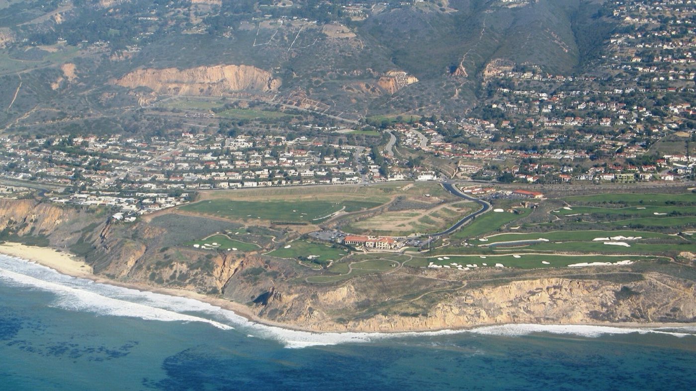
Trump National's ocean cliffs · Wikimedia Commons (public domain) · Real estate content by Properkey, CA DRE #01979718 · Equal Housing Opportunity