The community journal of the Palos Verdes Peninsula — four cities, one Hill Real estate on the Hill → properkey.us
Palos Verdes Life The Peninsula · 90274 & 90275
Home / The Cities / Rolling Hills
Incorporated 1957 · Population ≈ 1,700 · 3 square miles · entirely gated

Rolling Hills

Behind three gates at the crest of the Peninsula lies a city unlike any other in America: every street private, every fence white, every house one story, every night dark enough to see the stars. Ninety years on, the ranch is still the ranch.

The short version

A 1936 idea, preserved in amber

In 1936, landscape developer A. E. Hanson — working for Frank Vanderlip's Palos Verdes Corporation — laid out a "gentleman's ranch" community along the old crest road: big parcels, bridle trails instead of sidewalks, low ranch houses behind white three-rail fences. He wrote the look into covenants and founded the Rolling Hills Community Association to keep it. It worked beyond anything he could have imagined.

When postwar Los Angeles came climbing up the Hill, residents incorporated as a city in 1957 — one of the smallest and, by many measures since, one of the wealthiest in the nation. But the city has no commercial district, no streetlights, no sidewalks, and almost no visible government. What it has is land: canyons full of hawks and owls, pastures at a thousand feet with the entire coastline below, and a horse population that residents will tell you counts as citizenry.

Everything inside the gates is dual-governed: the City of Rolling Hills handles the municipal minimum, while the RHCA owns the roads, mans the gates, and enforces the aesthetic — single-story ranch architecture, white fences, no visible anything. It is the strictest design code on the Hill, and the reason Rolling Hills in 2026 looks like Rolling Hills in 1940.
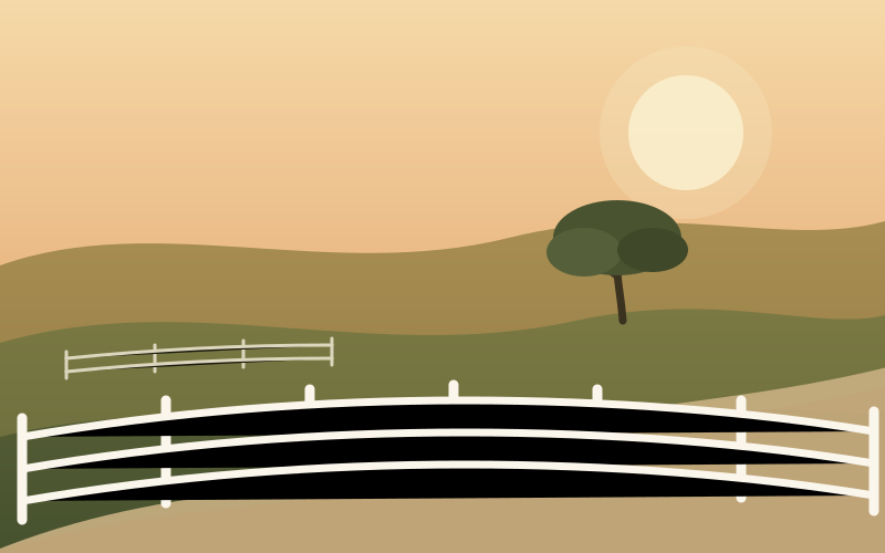
Illustration of Rolling Hills: white three-rail fences along a bridle trail through golden hills at dusk

Original illustration for Palos Verdes Life — Rolling Hills keeps photographers, like everyone else, outside the gates.
Fact sheet

Rolling Hills at a glance

IncorporatedJanuary 24, 1957
Population1,739 (2020 Census) — the Peninsula's smallest city
Land area≈ 3 square miles, entirely within private gates
Minimum lotRoughly one acre and up; many parcels far larger
The rulesSingle-story ranch architecture · white three-rail fences · no streetlights or sidewalks · dark-sky nights
GovernanceCity of Rolling Hills (municipal) + Rolling Hills Community Association (roads, gates, design) — rolling-hills.org
City hall2 Portuguese Bend Road, just inside the main gate
ZIP code90274 (Rolling Hills / Palos Verdes Peninsula)
SchoolsPVPUSD — Dapplegray Elementary, Ridgecrest or Miraleste Int., Peninsula High; Rancho del Mar HS sits on Crest Road

Visiting? You'll need a reason

All three gates are staffed, and entry is by resident authorization only — there is no public access, no through traffic, and no sightseeing loop. Real-estate showings are arranged through listing agents, who register visitors with the RHCA gatehouse. It is the rare American city you cannot simply drive through — which is precisely the point.

Land, honestly

Parts of southern Rolling Hills sit above the same ancient slide complex as Portuguese Bend — the Flying Triangle area has a documented movement history, and hillside parcels citywide warrant serious geotechnical review. Ask before you offer; the canyons keep secrets. Our land-movement explainer →

The lay of the land

The gates and the ridges

Area of the city (tap for a one-line profile) Gate or landmark

Streets beyond the gates are private; this map shows general areas rather than public routes. Positions are approximate.

Inside the gates

The territories of Rolling Hills

Rolling Hills has no named subdivisions — addresses are known by their road. But residents think of the city in territories, each with its own weather, view, and horse logic.

Portuguese Bend Road — the spine

Main gate → the saddle

The ceremonial entrance: through the main gatehouse off Palos Verdes Drive North, past city hall and the RHCA offices, the white-fenced corridor climbs between pastures toward the crest. The community's shared life clusters here — the riding rings, the tennis courts, and the storied Caballeros barbecues that have marked Rolling Hills summers for generations.

Crest Road — the summit

The top of the Hill · 1,000+ feet

Along the Peninsula's spine, Crest Road parcels look two ways at once — the whole sweep of the Los Angeles basin and the San Gabriels on one side, Catalina and the open Pacific on the other. These are among the most valuable residential acres in California, and some of the most discreet: from the road you see fence, lawn, and sky, and nothing else. Rancho del Mar High School and the crest radio towers mark the western end.

Eastfield Drive — the east side

Eastfield gate · harbor light

The city's eastern territory rides its own ridge above George F Canyon, entered through the Eastfield gate off Palos Verdes Drive East. Morning sun, harbor-and-bridge views, and quick access (by Rolling Hills standards) to the outside world. The bridle-trail loop around Eastfield is a resident favorite.

Middle Ridge & the canyons

The interior · wildest ground

Between the spine and Eastfield run the deep folds — Georgeff, Willow Springs, and their tributary canyons — where the city keeps its wildlife: red-tailed hawks, great horned owls, the occasional bobcat, and the peafowl whose dawn opinions divide the Hill. Interior roads like Middle Ridge and Saddleback hold some of the city's original 1930s–40s ranch houses.

The Flying Triangle

Southwest slope · the moving corner

Where Rolling Hills tilts toward Portuguese Bend, the Flying Triangle area shares the Peninsula's famous geology; movement here began in 1979–80 and destroyed at least a dozen homes through the 1980s. The 2023–24 acceleration reached this corner again — parts of the Flying Triangle, Cinchring Road, and Quail Ridge areas lost utilities, and the city has pursued its own state-supported voluntary buyout program modeled on RPV's. It is a working lesson in why Rolling Hills due diligence starts with a geologist. Ongoing status: pvlandslide.com's peninsula-wide tracker.

"No sidewalks, no streetlights, no stoplights, no stores. It sounds like what a city lacks — until you stand on the crest at dusk, hear nothing but horses, and understand it as what a city kept."

Why residents stay for fifty years

1936

A. E. Hanson lays out the ranch community for the Palos Verdes Corporation; the RHCA is founded and the first white fences go up along the new bridle roads.

1957

Facing the postwar annexation wave, residents incorporate the City of Rolling Hills — preserving the covenants, the gates, and the one-story skyline in municipal form.

Today

Fewer than 700 households keep one of the country's most intact planned landscapes: a working equestrian city where the 1936 rulebook, gently updated, still governs every fence post.

Recent activity

On the market in Rolling Hills


The full Hill market →

A sample of current Rolling Hills activity — the Real Estate page has the Hill-wide listings, map, medians, and market notes. Every property links to its page at properkey.us. Data powered by Properkey.

Real estate

Buying or selling in Rolling Hills

Rolling Hills is the Hill's least liquid and most misunderstood market: a handful of sales a year, enormous variance between parcels, and value driven by land, view, stability, and RHCA realities more than by the house itself. Showings require gate arrangements; serious geotechnical and title work is non-negotiable. This is a market you enter with representation.

Illustration of a horse and rider on a Peninsula bridle path

Real estate content by Properkey, CA DRE #01979718 · Equal Housing Opportunity