Twenty-six square miles of marine terraces rising nearly 1,500 feet out of the Pacific — four cities, fifteen miles of coastline, one school district, and some of the most storied neighborhoods in Southern California. This is the resident's guide to all of it: the news that matters, the schools, the trails, the history, and the homes.
Rolling Hills Estates is processing a 454-unit mixed-use project on Deep Valley Drive and has approved 90 homes at the Peninsula Shopping Center, while the Promenade itself leans into entertainment tenants. The Hill's real housing pipeline runs through Peninsula Center. The full docket →
Thousands of Pacific gray whales pass Point Vicente each winter on the Baja migration. The ACS-LA census runs daily from the Interpretive Center bluff — bring binoculars and say hello to the volunteers. Whale-watching guide →
Like districts across California, Palos Verdes Peninsula Unified is planning around declining enrollment and tighter budgets while defending some of the state's top academic results. Our schools guide, with boundary maps →
The dewatering campaign is working: the August 2026 survey put average movement under an inch per week for the first time since the acceleration began. Seaview and the Beach Club have power back; the Portuguese Bend Community Association area is the neighborhood still waiting, with Abalone Cove (1.29 in/week) still above SCE's line. Deep coverage at pvlandslide.com; our explainer is here.
Peninsula homes trade on ocean view, lot, and school boundary more than square footage. See what's for sale and what just closed — 225 homes on the market Hill-wide — on our Real Estate page, with data powered by Properkey.
Know something that belongs here? Send it in.
Alert SouthBay, evacuation zones, and the numbers for when it matters.
Sheriff, PVE Police, fire, and all four city halls — verified numbers.
Pickup schedules by city, SCE, SoCalGas, and Cal Water.
PV Drive South status, Preserve closures, and PV Transit.
The full switchboard lives on the Residents page.
The Peninsula's largest city holds nearly all of its coastline — the lighthouse at Point Vicente, Terranea, Abalone Cove's tide pools, the Nature Preserve, and more than two dozen distinct neighborhoods from Miraleste's pepper-tree lanes to the bluff-top streets of Seaview.
The original "City of Dreams," master-planned by the Olmsted Brothers a century ago, where a quarter of the land is protected parkland forever. Four storied neighborhoods — Malaga Cove, Valmonte, Lunada Bay, and Montemalaga — each with its own character and its own plaza-era architecture.
Behind three gates at the crest of the Hill lies one of America's most private cities: white three-rail fences, ranch houses on acreage, bridle trails instead of sidewalks, and dark skies by design. A working equestrian community that has guarded its way of life since 1936.
The crossroads of the Peninsula — home to its town center, its theater, its botanic garden, and its deepest equestrian traditions, with 25 miles of bridle trails threading between neighborhoods like The Ranch and Dapplegray Lanes. "A rural community in an urban setting" is official policy here.
Plus the unincorporated communities of Westfield and Academy Hill, and everything that binds the Hill together — covered on The Peninsula page.
Ten million years ago the Peninsula was an island. It still acts like one. Thirteen ancient marine terraces step down from San Pedro Hill to the surf, Catalina floats twenty miles off the bluff, and the marine layer burns off the coves an hour after it clears the mainland.
The Hill shares a single school district, a single library district, and a geography that shapes everything: where the fog sits, which streets have views, why the land moves at Portuguese Bend — and why people who grow up here spend the rest of their lives trying to get back.
Understand the Hill
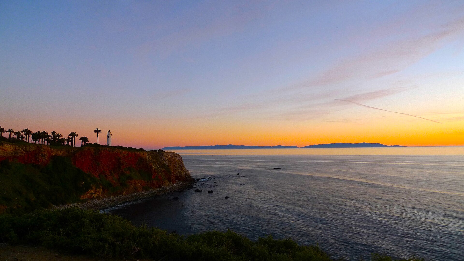
Catalina from Point Vicente · Thampithangavelu, CC BY 4.0, via Wikimedia Commons
Palos Verdes Peninsula Unified is consistently ranked among the top districts in California — and school attendance areas quietly shape the Hill's real estate market. Which elementary serves which neighborhood? Where is the line between Palos Verdes High and Peninsula High? What about Eastview's unique district choice?
Our schools guide answers all of it, with an interactive map of attendance boundaries for every level.
Schools & boundary map
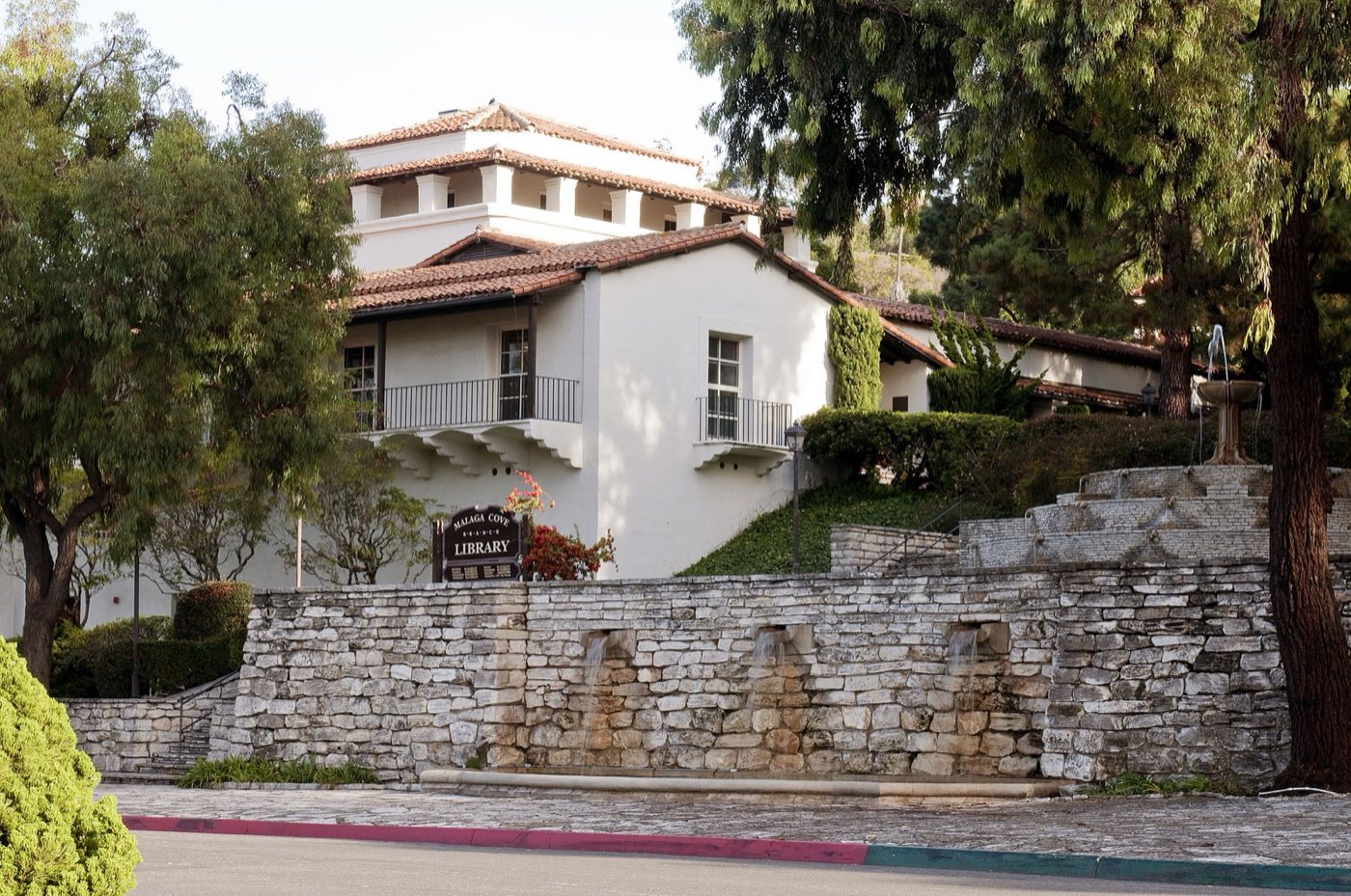
Malaga Cove Library (1930) · Palos Verdes Library District, CC BY 2.0, via Wikimedia Commons
Notable listings and recent sales across all four cities — with the medians, the map, and the market notes, updated as the Hill moves.
How Hill real estate actually works — the view premium, geology, school lines, and the rulebooks that keep the Peninsula looking like itself.
The engine behind our data: listings, neighborhood-level valuations, lending, and insurance for the Hill, at properkey.us.
All real estate, lending & insurance information provided by Properkey · CA DRE #01979718 · Equal Housing Opportunity
Every restaurant, café, market, and store on the Hill — Malaga Cove to the Terraces — with links to menus and websites.
Whale of a Day, the Portuguese Bend Horse Show, GLOW at the garden — the Hill's year, season by season.
About 1,500 acres of coastal-sage preserve, the Del Cerro overlook, and 30+ miles of trail.
Abalone Cove, Bluff Cove, the surf lineups of Lunada Bay and Haggerty's, whale season at Point Vicente.
From the Olmsted-era Palos Verdes Golf Club to the ocean-cliff holes of Trump National and Los Verdes.
The bridle-trail network, Empty Saddle Club, Ernie Howlett Park, and the horse-keeping tradition.
An occasional letter for Peninsula residents — land-movement updates, city decisions that matter, school news, and what's coming to market. No noise, no spam, unsubscribe anytime.